
Lockheed Martin’s CDL Systems launched new software enabling drones to create 3D-maps of surrounding terrain as they fly.
Five years ago, Lockheed Martin announced the acquisition of CDL Systems, a company specializing in the development of software for unmanned systems. CDL Systems serves military, civil and commercial customers with its vehicle control station software for unmanned systems.
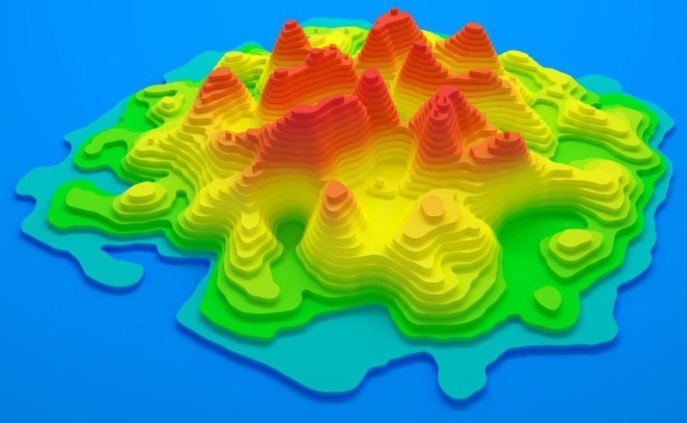
Hydra Fusion Tools to Process 3D Maps in Real-Time
CDL Systems develops and licenses a portfolio of products, among which is Hydra Fusion Tools–Lockheed’s answer to Big Data management.
Drone Software to Process 3D Maps in Real-TimeClick To TweetDrone operators have to deal with a constant flow of data–images, videos, and intelligence–that they have to process and fuse into a coherent operational presentation.
Hydra Fusion Tools eliminates the need for this lengthy and complex process by creating an accurate 3D picture in real-time as the unmanned system is in the air. HFT also could support multiple drones and process their data feeds simultaneously, showing all systems in a single display that is fully optimized and interactive.
At 30 knots speed, unmanned systems powered by HFT could generate maps with 30 cm per pixel resolution and, at lower speeds and altitudes, the resolution could be as high as 2.5 cm per pixel. All this in real-time, using one or multiple drones. CDL Systems’ Hydra Fusion Tools could revolutionize photogrammetry.
What is Aerial Photogrammetry?
In the 1930s, geographers and topographers discovered the potential of aircraft as a platform for cartographic photography. Thus, photogrammetry was born.
Aerial photogrammetry is the set of techniques and materials used to make representations of an extended territory from aerial photos; to determine the dimensions and volumes of objects from measurements taken within photos that show the perspectives of these objects. It allows, for example, obtaining orthophotos used to measure distances with mathematical precision.
In addition to cartography and topographical mapping, photogrammetry has many other applications in spatial planning, civil engineering, forestry, agriculture, environment, cadastre, architecture, geology, and archeology.
Now, these new technologies have made the photogrammetry even more convenient and useful. Gathering data (hi-res aerial images) is more than ever accessible and easy with drones, and automation systems, such as Lockheed’s Hydra Fusion Tools, streamline the processing phase.


Comments (0)
Least Recent